2023-06-15 22:38:00 (?): Rock slope failure in Brinzauls, CH
The massive slope failure (46.675, 9.594, 1400 m asl.) has been reported to happen around midnight (link). Seismic stations of the Swiss network (CH) were running very close by: Station CH.SVAM was 6 m northwest of the failure site, station CH.SCHK 13 km to the north, station CH.BERNI (a broadband sensor) 42 km southeast. Surprisingly, the seismic signature is very hard to see in the 18 h long overview plot below.
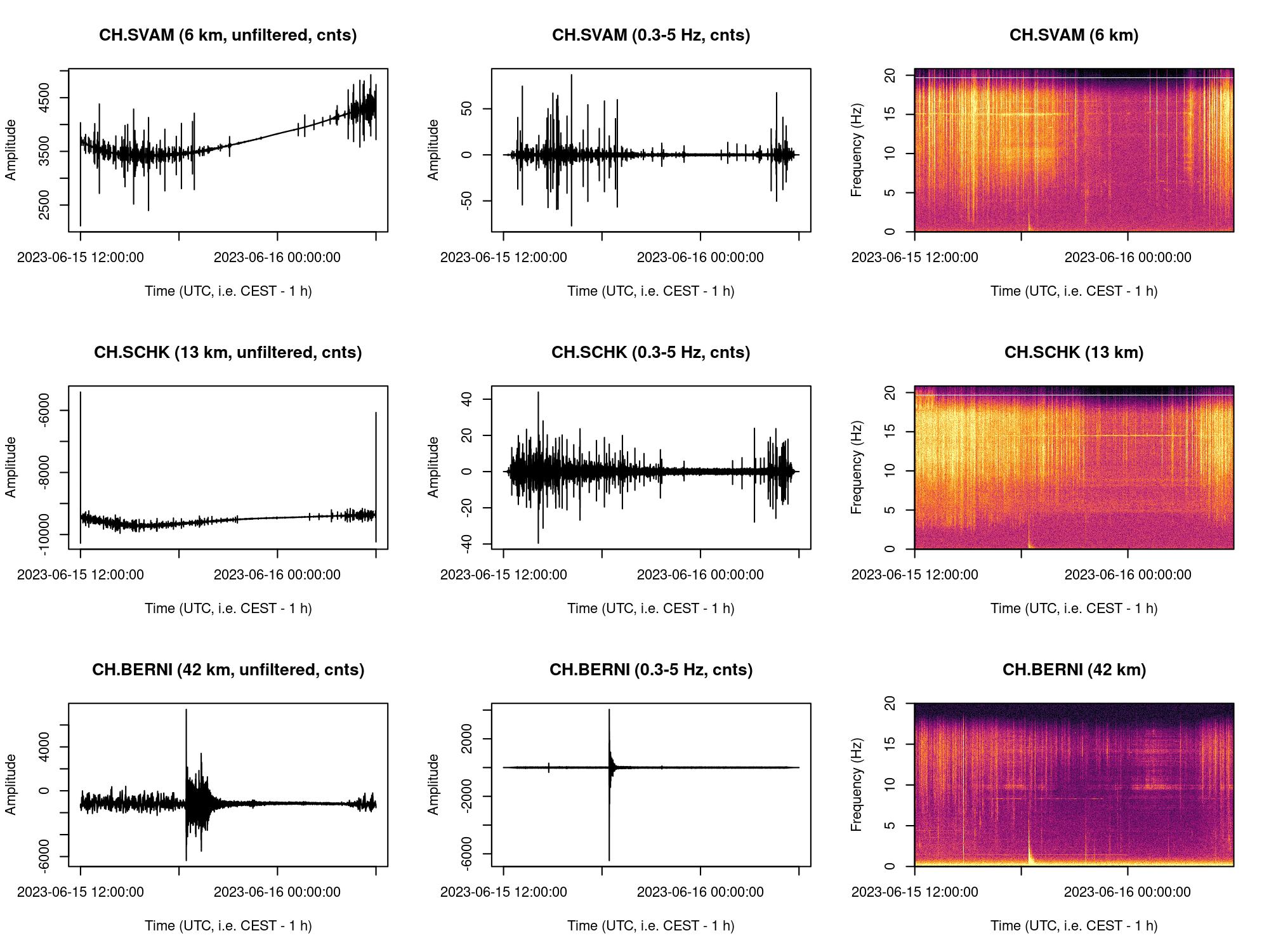
Note the strong earthquake around 18:26 UTC (i.e. 19:26 local time) visible by its low frequent content and triangular spectral shape. That event is best visible at CH.BERNI. Only faintly visible, there is a further signature of elevated seismic energy between 22:30 and 23:00 UTC (i.e. 23:30 and midnight local time). The zoomed in plot below shows the most active time span of that signature, preceeded by one more powerful seismic pulse around 21:38 UTC (see further below).
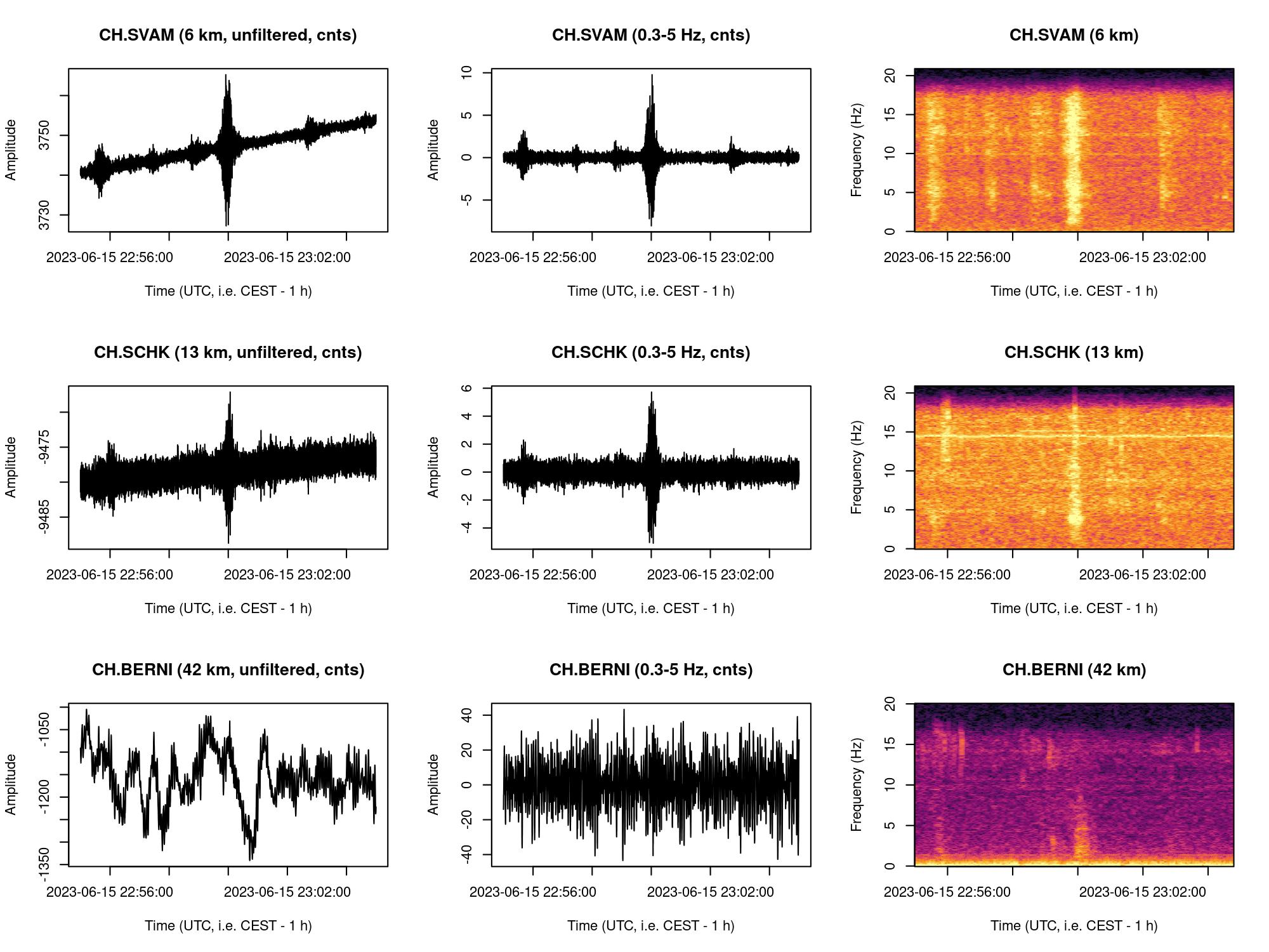
The spectrograms and seismograms above show a sequence of seismic events, each lasting between 30 and 60 seconds, and showing a gently increasing and decreasing amplitude. The seismic power is broad band but lacks energy below 1 Hz.
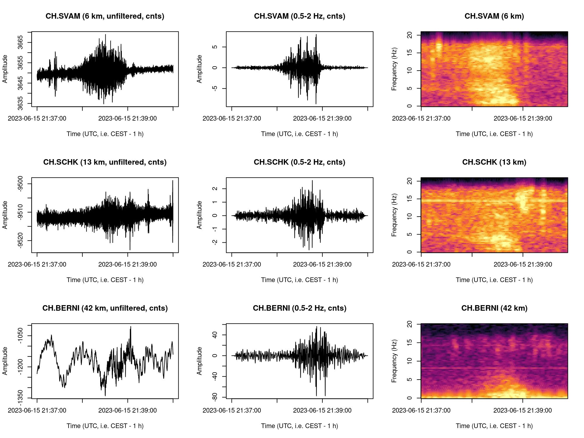
Zooming to the first commonly recorded signal, starting at 21:37:55 UTC and lasting for about 78 seconds, reveals perhaps the most active part of the failure. The seismograms show a slowly increasing amplitude which declines after reaching its peak around 21:28:30 UTC. However, the filtered seismogram (here, using the window 0.5-2 Hz) of the closest station CH.SVAM shows four discrete peaks in seismic amplitude. In summary, the Brinzauls slope failure continues to surprise me in its evolution, and I am keen on collecting and analysing the seismic data colelcted by the geophysical sensors we have deployed in the proximal area since 2021.
All data downloaded from www.fdsn.org/networks/detail/OE and processed with R package 'eseis'. R code available here
2023-06-11 15:05:39 CEST: Rock slide at Fluchthorn, AT
The massive rockslide (46.893, 10.227, 3350 m asl.) has been recorded by numerous seismometers across the Alps. The closest ones were accelerometers from the Swiss network (CH.SCUC, CH.SARD), but broadband stations of the Austrian network (OE) provide a clear signal of the event.
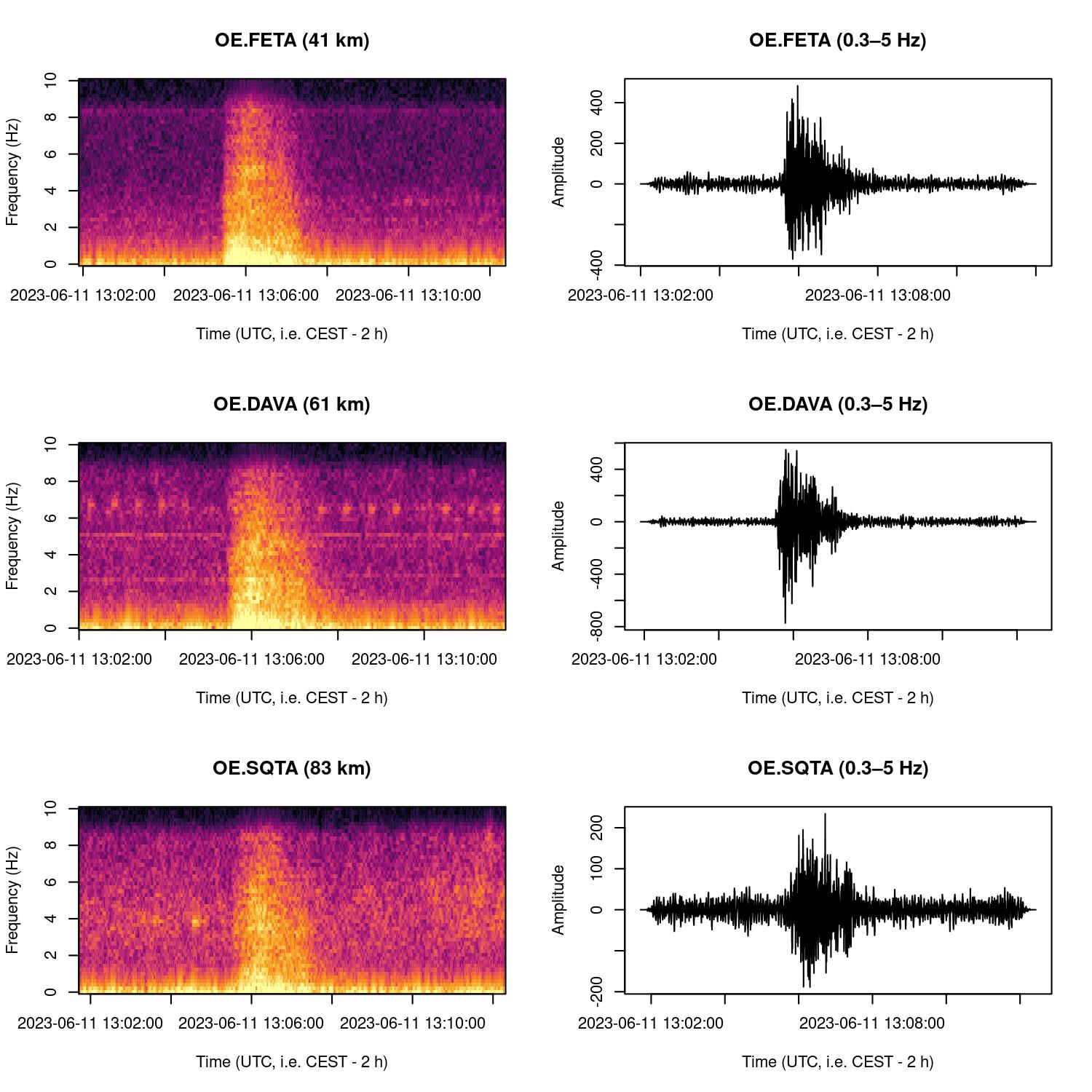
The spectrograms and seismograms above show the event started around 15:05:30 CEST and lasted almost two and a half minutes. Both spectrograms and seismograms show a rapidly rising amplitude that peaked after some 30 seconds after which it started to fade away for another two minutes at least. The low frequency content (< 0.1 Hz, not shown as seismograms) exhibits three distinct peaks separated roughly by 14 seconds from each other. The emergence of the first peak is roughly in agreement with the time span between detachment and impact on the glaciated valley floor where the fragmented rock mass spilled over a (moraine?) shoulder (see Youtube video and ).
All data downloaded from www.fdsn.org/networks/detail/OE and processed with R package 'eseis'. R code available here